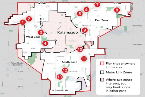
Metro Link Map - Explore the Areas Covered and Points of Interest
It is all about location, location, location…
Metro Link was launched on April 15, 2024, and has been favorably received in the early stages of the pilot program. However, Metro Link is a different kind of public transportation and comes with lots of questions. The most frequently asked questions are regarding service areas and where riders can travel with Link.
Think of Link as an extension of the traditional bus system. Kalamazoo County is large, and it is difficult to provide sustainable traditional public transportation to all areas. Metro Link is designed to connect riders in those areas to the Metro bus system and provide greater access to their community.
Curious about the area each Link zone covers and points of interest? Check out the Metro Link Service Zones map below. The area outlined in red is the Central County Transportation Authority service area with each Link zone defined: East (Blue), West (Purple) and South (Yellow). A downloadable PDF is also available here!


